| Map Library | Right Click Image to Download File |
| Gold Territory Historical Topos |
|
JPG 7.2Mb |
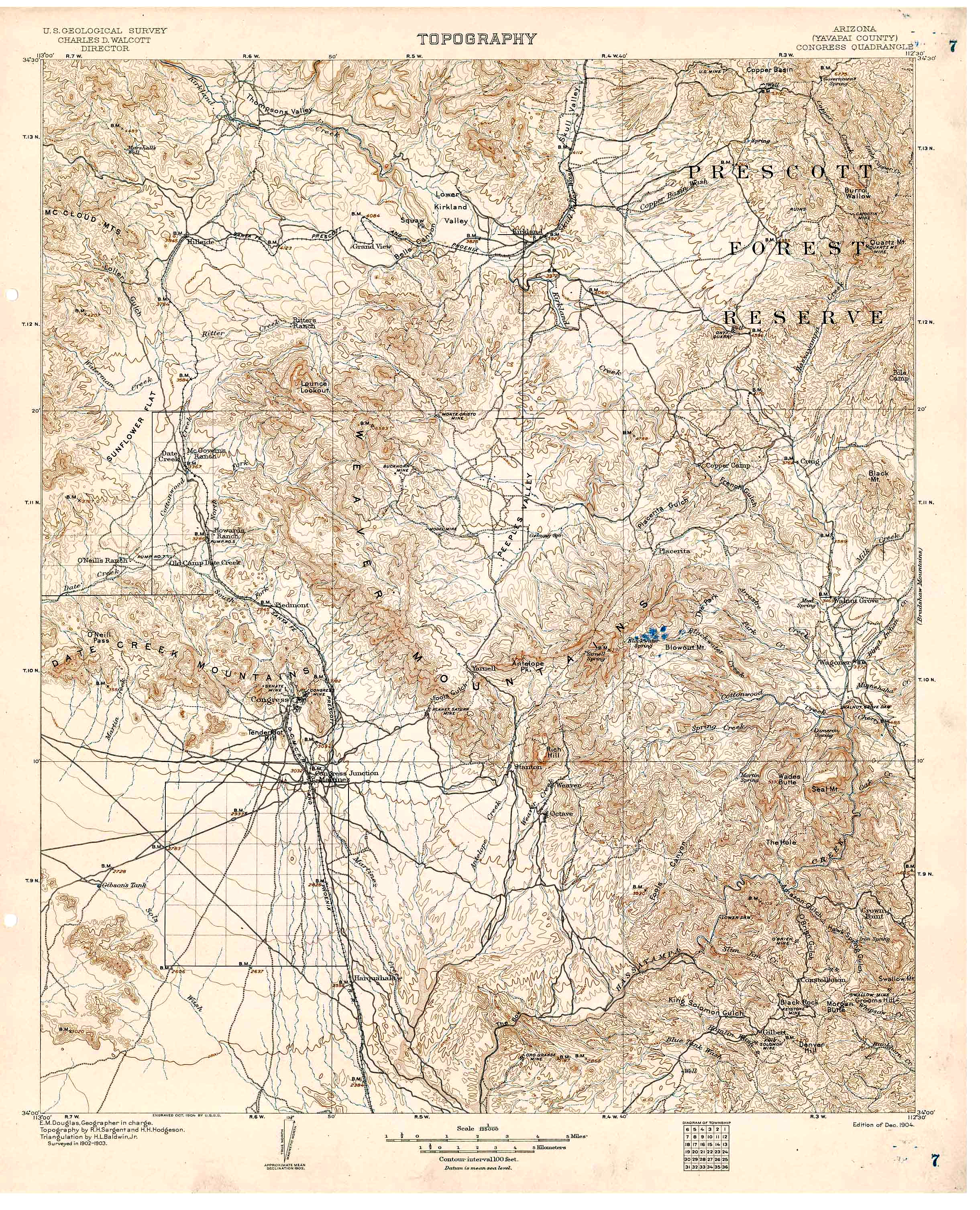
USGS
Congress Quadrangle, This is the large Congress Quad that covers the area from Skull Valley in the north to Walnut Grove in the East including Rich Hill and the Weaver Mining District. |
|
JPG 11 Mb |
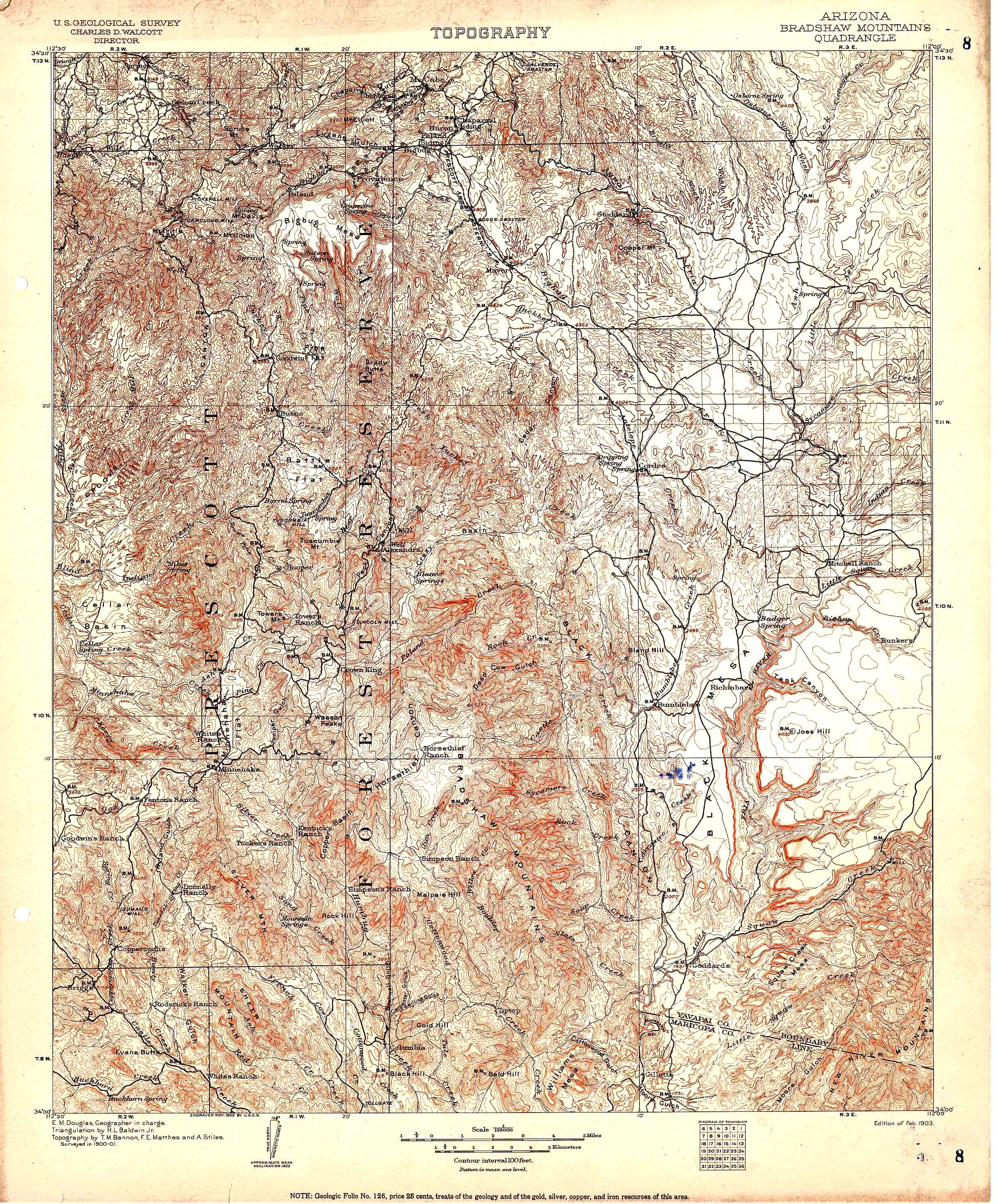
USGS
Bradshaw Mountains Quadrangle, The extent of this Quad is from Big Bug in the north, to Williams Mesa in the south.It covers great, historic gold territory. Including Black Canyon, Minehaha and Crown King. |
|
JPG 9.4 Mb |
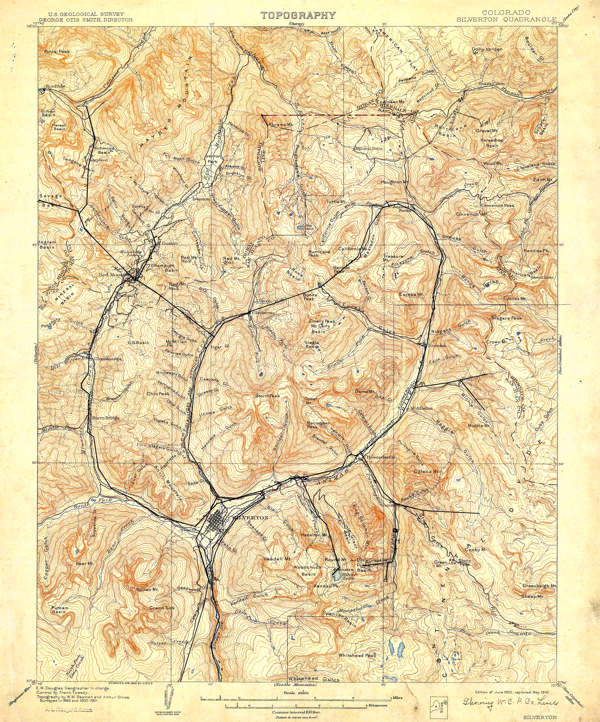
USGS
Silverton Quadrangle, Right on the continental divide, this quad is home to the famous mines of Silverton. |