February 26, 2010
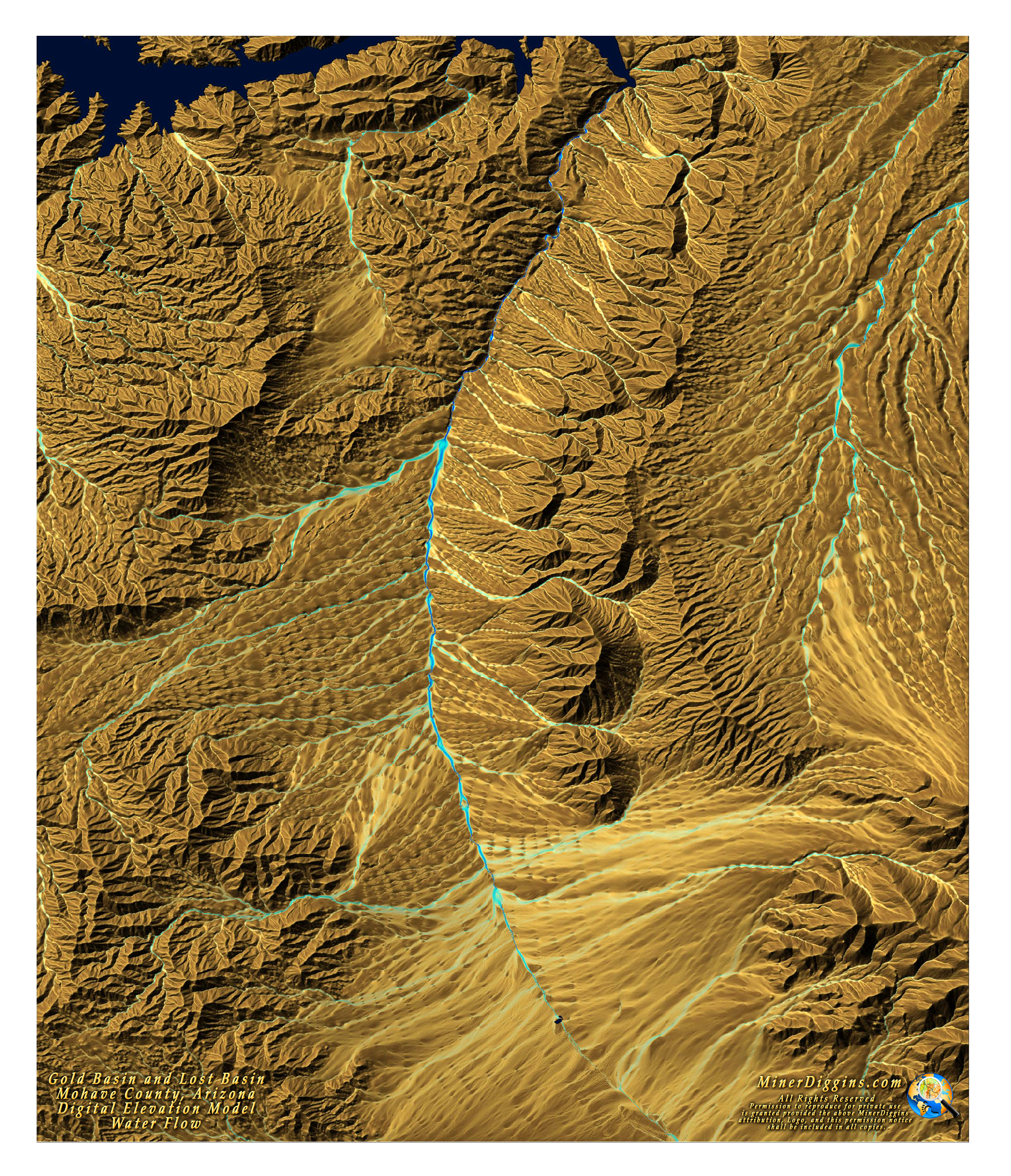
Miner Diggins is in the process of mapping a new FootPrint for Gold Basin & Lost Basin in Mohave County Arizona. This is a map I created as part of my research for the project. Its a 3D terrain map with a water flow overlay.
I started with a digital elevation model (DEM) from the USGS. I created a shaded elevation file and colored it "desert". After deriving the water flow from the same DEM, I draped it over the top of the shaded elevation. I'm not sure this will be the final product, but I reduced the resolution so that you could make a printable wall map. It's 34" x 40" at 72 dpi, of course, the final print resolution size is up to you.
I love making these maps. It gives you a real good sense of how water moves around the area. The land out here is a real jumbled mess and its fascinating to me to see it in this manner. But then again, I am a map nut.
If you like it, feel free to download the map, print it and share it. Please keep the permissions statement intact
Click
on the image for a high resolution jpeg. Right Click to Download.
(The
image is large at 7M)
The new FootPrint for Gold Basin is scheduled to be out in April !
Click to the Next Page for some research tips on Gold Basin.